June 25: Researchers from Wadia Institute of Himalayan Geology (WIHG), Dehradun, an autonomous institute under the Department of Science and Technology, Govt. of India, have traced the paleoclimatic history of the Indus River in Ladakh Himalaya with the help of geometric data from overlapping gravels of channel fills.
They studied the discharge during periods in which the river experienced an increase in land elevation, due to the deposition of sediment) and its incision.
River Terraces are ubiquitous in mountains that nourish and help sustain past, present, and future human societies. These terraces are part of valley-wide aggradations, which has been studied extensively in Himalaya to understand the processes driving such a periodic increase in river valley land elevation and incision. Scientists are still debating whether wetter climate intervals with increased rainfall and glacial melting promote river aggradation through increased discharge and enhanced sediment load, or instead, is it during drier conditions when aggradation occurs through increased sediment to water ratio.
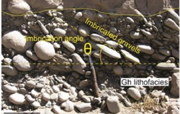
The researchers studied the discharge during periods of established river aggradation and incision of the Indus River, Ladakh Himalaya over late Quaternary (the current and most recent of the three periods in the geologic time scale). They used geometric data from overlapping gravels of channel fills to calculate paleodischarges during net river aggradation at 47–23 ka (thousand years),and preserved slack water deposits (SWDs) at 14–10 ka to constrain paleodischarges that occurred during net river incision.
They observed that the aggradation in the Himalayan rivers occurred in glacial-interglacial transient warm climatic conditions (33–21 ka and 17–14 ka) when the sediment budget in the rivers increased just after the glacial events.
Their study published in the journal Geomorphology shows that aggradation took place in the Indus River when sediment to water ratio was higher during MIS-3 (Marine isotope stages (MIS), marine oxygen-isotope stages, are alternating warm and cool periods in the Earth’s paleoclimate, deduced from oxygen isotope data reflecting changes in temperature derived from data from deep-sea core samples) and incision initiated when sediment to water ratio reduced during post-glacial climatically wet phase (early Holocene)
Source: PIB
Disclaimer: We donot claim that the images used as part of the news published are always owned by us. From time to time, we use images sourced as part of news or any related images or representations. Kindly take a look at our image usage policy on how we select the image that are used as part of the news.


